Land use change is one of the most important threats to biodiversity around the world. The effects of land use on biodiversity are most visible at local scales but are not adequately captured on the current global land use mapping. Global land‐use projections have a coarse spatial resolution, which means they do not capture small detail. Therefore, these estimates are unable to meet the needs of local research and decision-making.
In PONDERFUL we were working on two protocols to update the GLOBIO land use allocation model to further downscale land use projections at fine spatial resolution (100 and 10m).
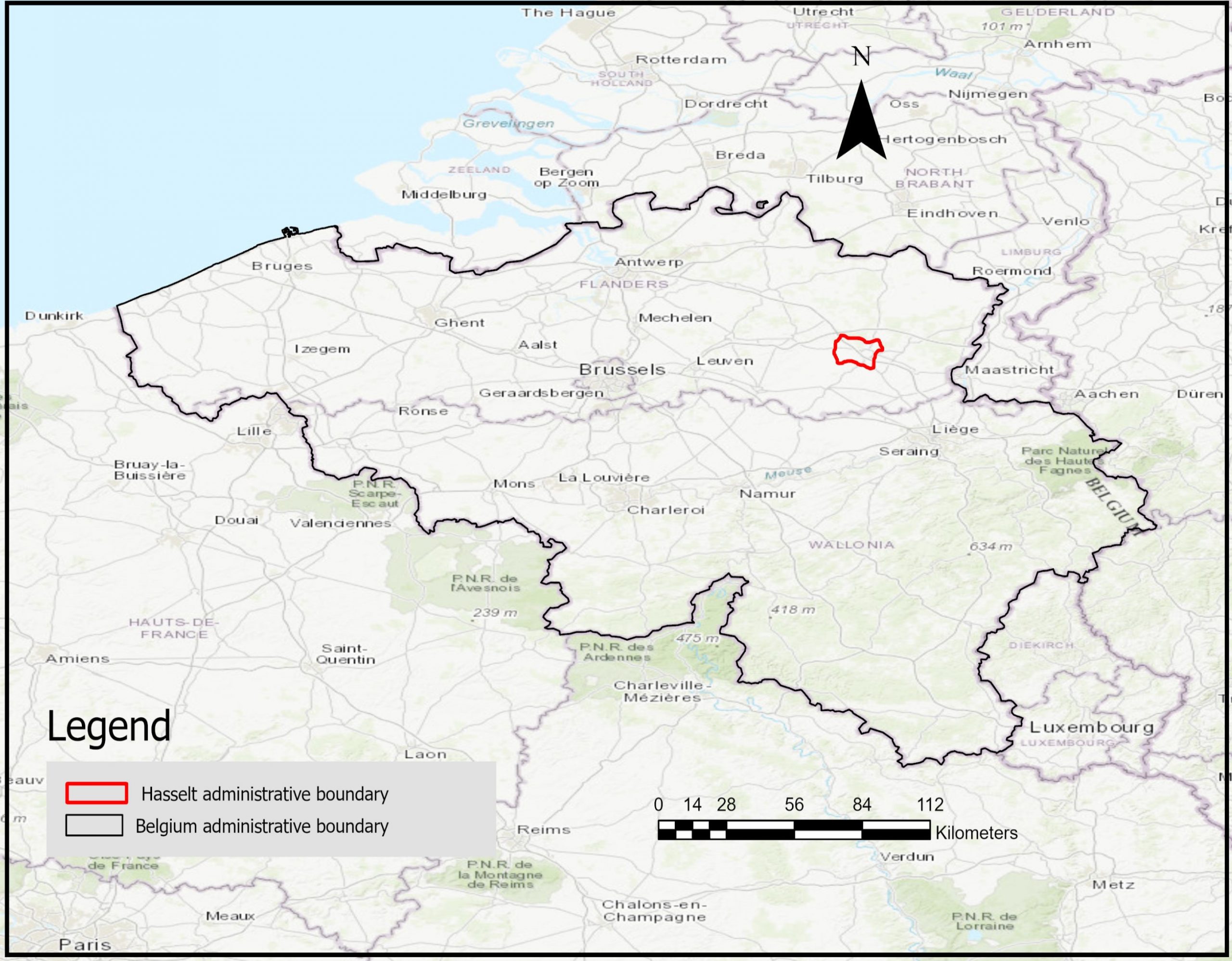
We focused our analysis on Belgium, which, despite its small size, contains a lot of geological variation. Our chosen study area at the local level is Hasselt which has a population of 68,000 and is located 70 kilometres east of Brussels in the Maas-Rhine region of Belgium. Hasselt was selected as the local level study area due to the high conservation value of its ecosystem.
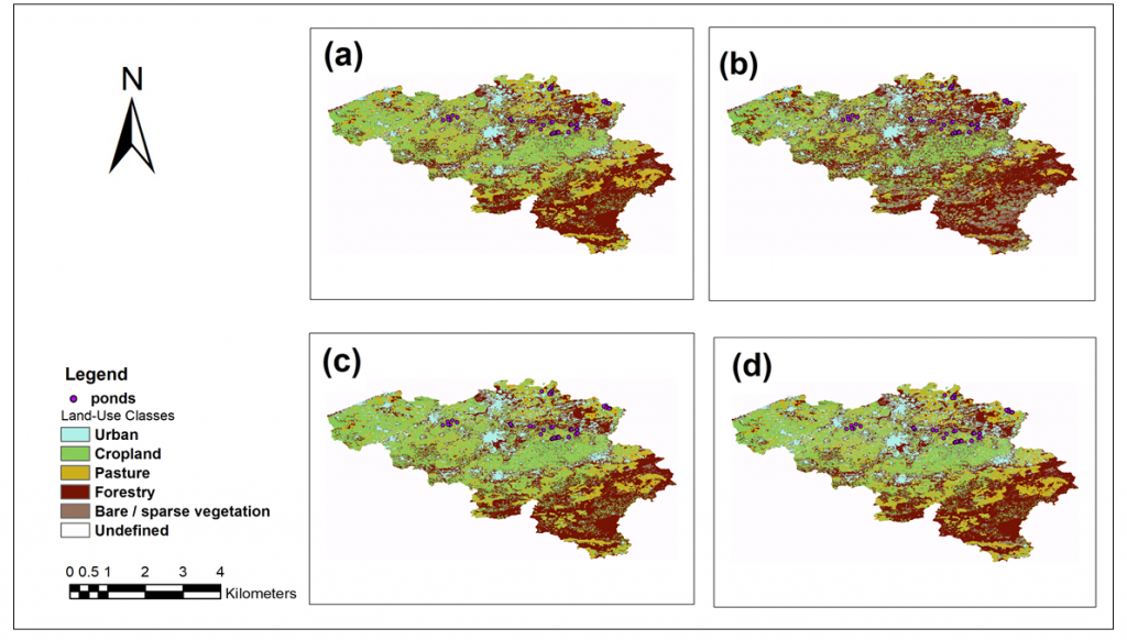
We produced future land use maps with fine scale resolutions (100 and 10 m). Figure below shows land use distribution with a fine resolution of 100 m at national scale in (a) present day (2018) and from a mild to a worst-case scenario, from b to d, respectively, for 2050.
Next figure below shows land use distribution with a fine resolution of 10 m at local level in (a) present day (2020), and from a mild to a worst-case scenario, from b to d, respectively, for 2050. Results from future land use maps show different patterns of land use types under various future scenarios were observed. The second figure below shows land use distribution with a fine resolution of 10 m at local level in (a) present day (2020), and from a mild to a worst-case scenario, from b to d, respectively, for 2050.
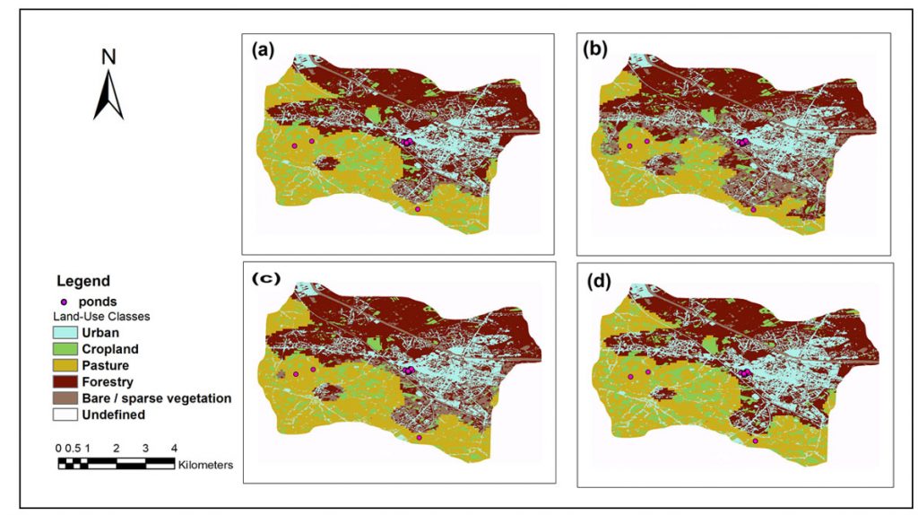
Results from future land use maps show different patterns of land use types under various future scenarios were observed.Our results from accuracy assessment indicated that the Globio land use allocation model is capable for downscaling global land use information to the fine spatial resolution at local and national level. Moreover, these high-resolution land use datasets can be effectively used, in conjunction with environmental models, to analyse land use change impacts on biodiversity at finer resolutions than previously possible.
Our next step, which is currently under way, will involve the co-development of scenarios by translating stakeholders’ storylines into maps and quantitative parameterizations.
By Sopan Patil and Parinaz Rashidi (Bangor University)